Description
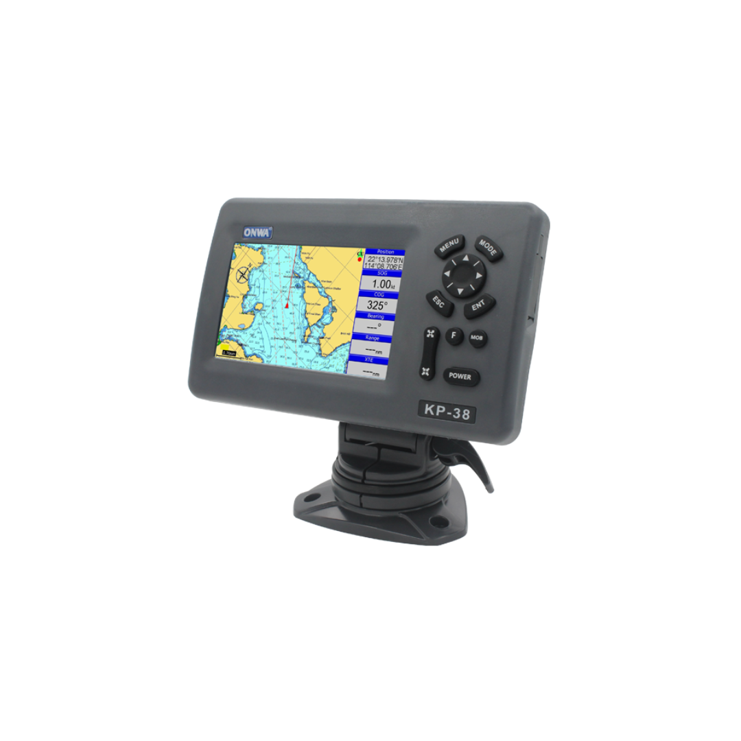
ONWA KP-38S 5-inch GPS Chart Plotter – Advanced Navigation for Precision Charting
The ONWA KP-38S 5-inch GPS Chart Plotter offers a compact, feature-packed solution for reliable marine navigation. Designed with cutting-edge technology, this device ensures accurate positioning, advanced route management, and user-friendly operation for professional and recreational boaters.
Key Features of the ONWA KP-38S GPS Chart Plotter
- Waypoints and Routes: Store up to 12,000 user waypoints with customizable names and symbols, plus 30 routes with up to 170 points each. MOB and Track Navigation modes make managing routes seamless.
- Tracks and Path Retracing: Automatically log 8,000 points per track with the ability to save and retrace 10 tracks, each up to 8,000 points.
- Custom Alarms: Includes XTE, anchor drag, arrival, speed, voltage, proximity waypoint, timer, and AIS alarms for enhanced safety.
- Detailed Drawing Tools: Create up to 1,000 marks, 2,000 lines, and 1,000 place names with an 8-color palette for customization.
- Tides and Celestial Data: Access built-in worldwide tide data, along with sunrise, sunset, moonrise, and moonset times.
GPS Receiver Highlights
- Tracks up to 50 GNSS satellites simultaneously, supporting GPS, Beidou, GLONASS, and Galileo.
- Offers high accuracy with 3-meter positional precision and a 1-second update rate.
- SBAS and QZSS compatibility improve navigation in demanding conditions.
Display and Durability
- 5-inch Color TFT Display: High-resolution, sunlight-readable screen with customizable modes for daylight, night, and NOAA paper chart palettes.
- IP66 Waterproof Rating: Rugged construction ensures reliable operation in harsh marine environments.
Power and Versatility
- Powered by 12-24VDC or a power bank for up to 14 hours of operation at maximum brightness.
- Compact size (169mm x 198.1mm x 77mm) and lightweight design (0.6 kg) make it portable and convenient.
The ONWA KP-38S 5-inch provides advanced charting, accurate positioning, and intuitive operation for safe and efficient marine navigation. Upgrade your boating experience with this powerful and versatile tool today!


